Seismic Exploration
Acreage that is deemed to have potential production capabilities is typically further evaluated through the utilization of seismic imaging. Seismic is a valuable tool for the oil and gas industry. It is used to determine depth and orientation of rock formations. Sound waves are shot deep into the earth by the use of vibrator trucks (also called thumper trucks) or explosives. The earth’s crust is composed of many layers of rock. Properties that are unique to each type of rock cause seismic waves to be reflected back to the surface at different rates. Magnetic recorders then note the length of time it takes for those waves to reflect back up to geophone receivers on the surface. Then specialized software processes the data which results in 2-D seismic profiles that can then be interpreted by geophysicists and reservoir engineers. Today most seismic surveys use a two-dimensional arrangement of geophones and a two-dimensional grid of energy sources. This results in a three-dimensional image of the geology being surveyed and is referred to as 3-D seismic imaging.
Site Selection & Construction
 Determining the right well site location based on the data is very important prior to drilling. After a lease agreement is signed, a number of factors including geography, topography, access to roads and pipelines and utilities must be taken into consideration. Our pad sites are designed to minimize our footprint as much as possible while safely accommodating the drilling rig and associated equipment. During this time, we also install secondary containment equipment, diversion berms and any other needed equipment. Each of our sites is permitted and regulated by federal, state and local agencies as needed.
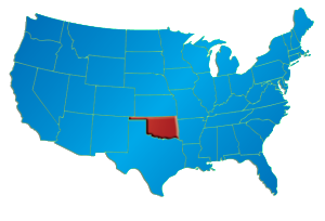
Oklahoma’s SCOOP and STACK oil plays … Some of the best rock seen anywhere!
Traveling through Oklahoma’s stratigraphy, one can stumble over as many as 7,500 formations. “Most have names; in some cases, several,” the Oklahoma Geological Survey explains in an oil and gas FAQ page. The abundance of nomenclature is the result of many factors, the OGS adds, including simply that, at times, “geologists may disagree.”
The state also hosts more than 3,000 field designations. To simplify, strat-trippers can cheat down to the 300 formations that have had 10 or more well completions. Among them is the Woodford Shale, which Newfield Exploration Co. proved commercial from fracked horizontals beginning in 2005 where the pay is gassy in the Arkoma Basin of southeastern Oklahoma. Read the full article at here at oilandgasinvestors.com