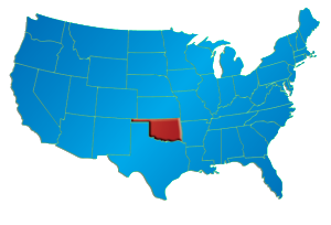
 JHP is currently examining and acquiring 3-D seismic data covering parts of the United States. Through this activity, JHP has developed an expertise in the selection of geologic trends that are suitable for 3-D seismic exploration. JHP uses the experience it gains within a trend to enhance the quality of subsequent projects in the same trend or within other analogous trends, contributing to lower exploration and development costs, compressed project cycle times and increased rates of return.
JHP is experienced exploring with 2-D and 3-D seismic imaging in a wide range of reservoir types and geologic trapping styles, both stratigraphic and structural, including reefs, salt domes, channel sands, complex faulted and fractured reservoirs and pinchout plays. JHP seeks to supplement its knowledge base with the best local geological expertise available for a particular geologic trend. In addition, JHP typically acquires digital databases for integration with its geophysical workstations, including digital land grids, well information, log curves, geological studies, geologic top databases and existing 2-D and 3-D seismic data. JHP uses this integrated knowledge to create maps of producing and potentially productive wells, enabling the company to precisely evaluate recoverable reserves and the economic feasibility of projects and drilling locations.
JHP acquires most of its raw seismic data using seismic acquisition vendors on either a proprietary basis or through alliances affording the alliance members the exclusive right to interpret and use the data for extended periods of time. In addition, JHP participates in nonproprietary group shoots of 3-D data when it believes the expected full cycle project economics are justified. In its proprietary acquisitions and alliances, JHP selects the sites of projects, primarily guided by its knowledge and experience in the core provinces it explores, establishes and monitors the seismic parameters of each project for which data is shot and typically selects the contractors and equipment that will be used. Data is generally priced on the basis of square miles shot.
JHP’s operations staff includes many individuals with decades of reservoir and operations engineering experience, most of which was gained in the company’s primary areas of activity. The engineering teams works closely with our explorers and are integrally involved in all phases of the exploration process, including the preparation of pre and post-drilling reserve estimates, analysis of full-cycle risked drilling economics, well design and production management. Our in-house operations team and third-party contract personnel conduct JHP field operations for its oil and gas properties. In an effort to retain better control of its project timing, operational costs and production volumes, JHP oversees every phase of each project throughout the project’s entire life cycle. This further ensures operational success for JHP and its financial partners.

